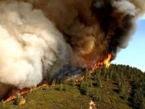
Residents pray for a shift in weather
Dozens upon dozens of homes have been destroyed due to the raging Colorado wildfires, stated Colorado Springs’ Mayor, Steve Bach, today. The full extent of the damage to the city, which is the second largest in Colorado, is still unknown; costs to rebuild will clearly be astronomical.
The size of the Colorado wildfire has doubled in size over the last several days, forcing thousands upon thousands of residents to flee the city. The situation has become so sever that even the Air Force Academy needed to be evacuated.
Though, if there is a change in weather, officials will have a better chance at quelling the Waldon Canyon Colorado wildfires.
As of Wednesday, the wildfire covered 24 square miles and was reaching towards the west edge of the city. They first began Saturday and were fueled thanks to 65-m.p.h. winds.
“We have had the first break in the weather in the days since we have been here,” Rich Harvey, Fire Incident Commander, said. “We are going to go after it today aggressively.”
However, the Colorado wildfires have helped to introduce some unique technology to the general public and are potentially saving lives. Esri and Google Maps are presenting maps of the fires location and path, which are continuously updated.
“The primary use is for residents wanting very current information on where the fire is and whether they’re going to need to evacuate or not,” said Michael Goodchild, a geographer at the University of California, Santa Barbara.
More than 32,000 people had to evacuate Colorado Spring Wednesday June 27.
President Obama is slated to tour the damage Friday.


